By listening to our clients’ needs and challenges, we’ve made a number of key feature updates in the Kalibrate Location Intelligence platform to better serve multiple departments across enterprise organizations. We focused on making data management easier, breaking down technical barriers, and putting location intelligence tools directly into users’ hands.
The advances we made this summer were extensive – this article highlights just a few key capabilities that demonstrate our commitment to evolving KLI based on real client feedback and operational challenges.
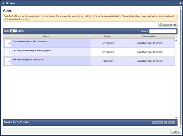
Public API
KLI’s Public API transforms the platform into a true integration engine. Connect KLI to any external system: Power BI, ArcGIS, Tableau, CRM platforms, or custom dashboards.
What it enables
- Seamless data sync – Push and pull KLI datasets directly to keep external systems current
- Automated forecasting – Schedule projections or trigger them when conditions change
- Batch drive-time generation – Create polygons in bulk with clean GeoJSON outputs
- Real-time demographic reports – Request any profile report on-demand via API
- Bidirectional data flow – Push updates back into KLI to keep models current
Key business impact
This isn’t just data access. It’s full-stack location intelligence automation that eliminates manual processes and connects KLI to your broader technology ecosystem. Below is a sample of how the API looks within the KLI Management Studio.
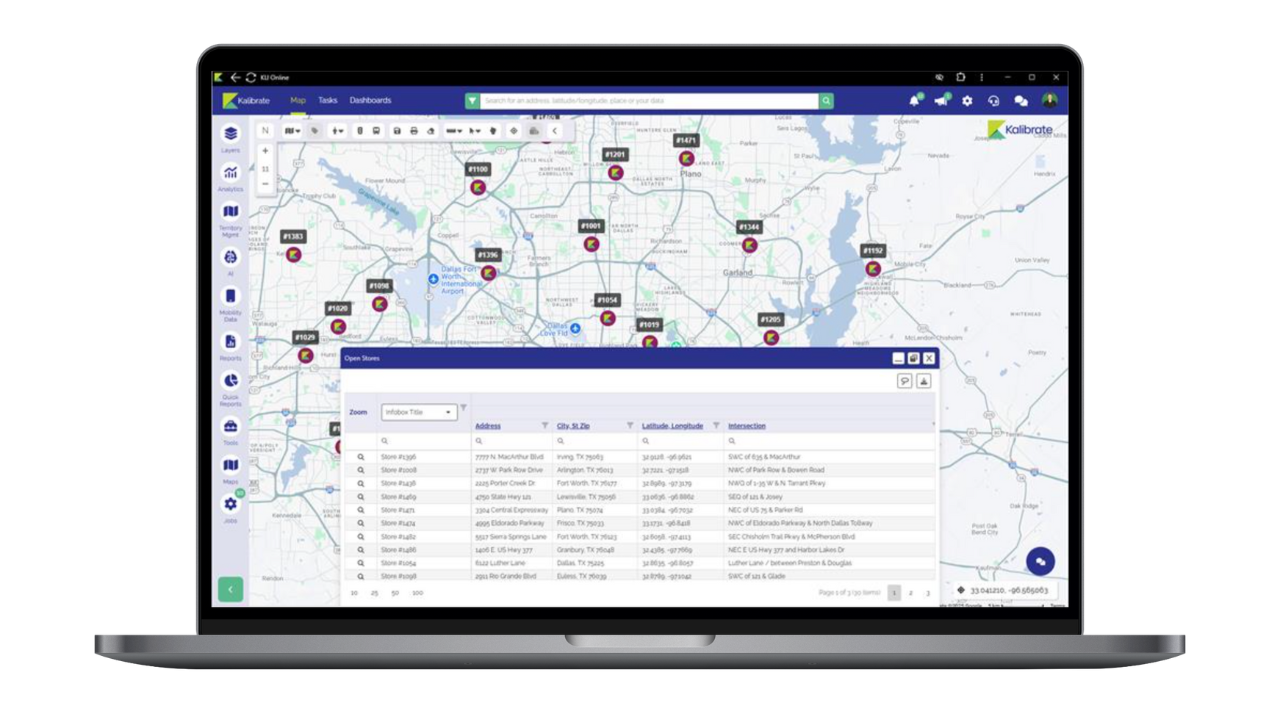
Data layer export
Extract datasets quickly and securely without writing code. Market planning and real estate teams get the data they need. IT maintains full control.
Core capabilities:
- One-click exports – Download any point or shape layer, filtered or complete
- No technical skills required – Business users grab data directly from the map
- Flexible formats – Export to Excel, CSV, or spatial formats
- Role-based permissions – Admins control access at table and form levels
- Real-time filtering – Export exactly what you need, when you need it
Problems solved:
- Teams no longer wait for GIS support
- Data sharing becomes standardized across departments
- Compliance stays enforced through granular permissions
- Analysts focus on strategic work, not data requests
Competitive Insights: Estimated visits + Enhanced reporting
For users for Competitive Insights, we’ve introduced Estimated Visits to calculate likely foot traffic within geofences. This methodology accounts for:
- Overall sample size by country
- Brand-specific geofence sizes
- Real-world performance alignment
The result? More accurate competitive comparisons that match actual business understanding.
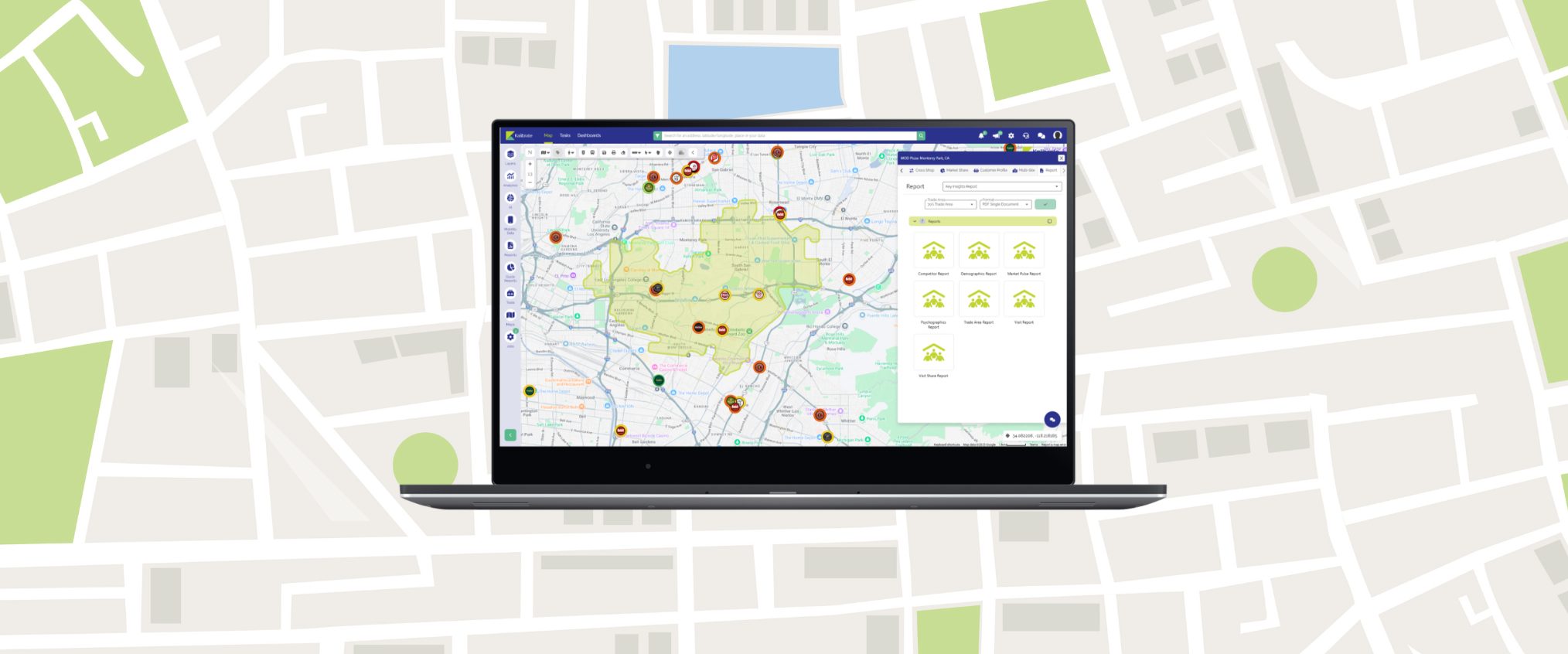
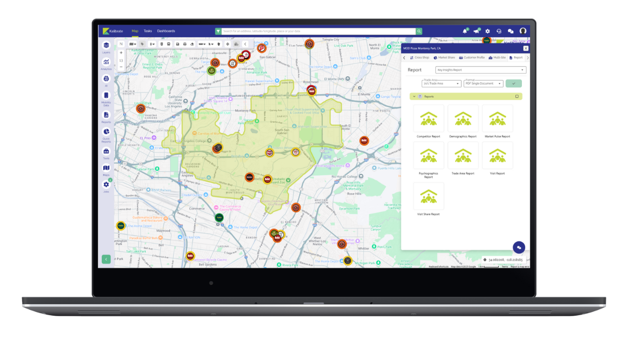
Upgraded reporting suite
Select individual report elements. Combine into single PDFs or generate separately. Run reports directly from the Competitive Insights activity hub.
Available reports:
- Competitor Report – Identify locations with highest cross-shop potential
- Demographics Report – Compare trade area demographics to visitor home locations
- Psychographics Report – Analyze Spatial.AI segments associated with visitors
- Market Pulse Report – See which nearby industries perform well or struggle
- Trade Area Report – Understand visitor travel patterns and distance trends
- Visit Report – Track location performance with year-over-year comparisons
- Visit Share Report – Context within broader channel performance
Want more detail on Competitive Insights? Download the brochure here.
Franchise territory mapping
An entirely new KLI capability for creating, editing, and managing custom territories.
Core features:
- Advanced drawing tools – Create territories with draw, merge, and split functions
- Bulk generators – Build ring and drive-time boundaries at scale
- Live data overlays – Demographics, foot-traffic, and thematic styling while drawing
- One-click reporting – Export territories as presentation-ready PDFs
- Guided interface – Non-GIS users can confidently edit boundaries
Business applications:
- Franchise territory definition
- Sales development management
- Market expansion analysis
See the franchise territory management tools in action in this webinar.
In September we’re launching Territory Manager – be on the lookout for details.